
Had them East Texas blues
And them West Texas too
I’ve done all I know to do
Tryin’ to lose these lone star blues – Delbert McClinton
The road from Big Bend to Guadalupe Mountains National Park folds back into the Chisos, passing Mule Ears Peak and Sotol Vista, before finding Santa Elena Junction and Route 118 north. In early morning fog, the Christmas Mountains sit patiently beneath a silent milky shroud, their majestic peaks laid upon by indifferent clouds. For one hundred miles, summits and crests become ghosts, reduced to something visually meager. Hidden, they wait. Knowing their grandeur has outlasted the ethereal remnants of heaven for millions of years.
Once past Alpine, Texas, Route 90 leads steadily northwest, black asphalt humming as I pass through wide open spaces. Wooden windmills, empty homes and black oval-headed oil rigs attempt to lend dimension and movement to the flat mesa landscape. You are deep in the high desert of the Trans-Pecos in west Texas. Large ranches with ornate logos begin to dot the landscape. Long horn steers sit in the sun, legs tucked, heads erect. Echos of Rock Hudson, James Dean and Elizabeth Taylor in George Stevens ‘Giant’ run through my head as the Davis Mountains spring up in the east. Ahead lies the imposing El Capitan and mountains that once grew beneath an ancient inland sea.

El Capitan from the northeast. A massive wall looming over the desert.

Between Big Bend and Guadalupe Mountains I fell in love. I offered him the van and $20 for the Hombres mobile. He laughed and crushed my dreams
As part of the 400 mile long, horseshoe shaped Capitan Reef, Guadalupe Mountains National Park protects one of three exposed sections of the world’s most extensive Permian fossil reef. Apache Mountains to the south and Glass Mountains to the southeast are also exposed sections of this 270 million year old marine fossil reef. Algae, calcareous sponges and a variety of lime-secreting organisms extracted from the sea to form the reef. For millions of years it lay beneath the ancient Delaware Sea. Only to be exposed after the waters receded and tectonic compression along the western margin of North America caused the region encompassing west Texas and southern New Mexico to be raised skyward. Today, the reef looms above the desert floor as it once towered above the bottom of the Delaware Sea.
One of the first things I noticed as the ranger spread out a trail map, was the complete absence of roads inside the park. A few make a small dent, but are short lived and merely act as access to trail-heads. Route 180 runs north south, skimming the eastern edge of the park and provides entry to the park headquarters and visitor center, but never enters the park. “If you want to explore the park,” says a young ranger by the name of Evan, “you have to hike in. A vehicle will not help you here, unless you simply want to drive around the fringe of the mountains.” I’ve already made that drive. Let’s look at some of the more interesting trails in the park. “My man” says Evan. I’m your man Evan.
Directly behind the visitors center, a trail leads to ruins of the 1858 Pinery Station, a stop on the Butterfield Overland Mail Line, precursor to the Pony Express. At the beginning of the trail there is a sign that reads ‘This is rattlesnake country. If you see a rattlesnake, give it a wide berth. Do not throw objects or harm rattlesnakes.’ Damn it! Don’t these people know I hate snakes? Why haven’t they cleared the park prior to my arrival? I tell myself to man up and off into the brush I go. I am a fearless explorer. I am a man. I built the railroad, I am dancing in place, hands waving on either side of my head as the rattlesnake moves away from the trail. Somewhere in the distance I hear a high pitched scream. Actually, it’s more like a squeal. My first thought is that a little girl is in trouble. Then I realize the squeal is coming from me. I look around to see if anyone else is dancing and trying out for the Vienna Boys Choir. Nope. Apparently I was the only one invited to audition. To my credit, I didn’t run – I am a man damn it – I didn’t pass out – I am a fearless explorer – and I finished the trail – I am a marvelous dancer.

Remnants of the Butterfield Overland Mail Line. This photo was taken approximately 1/4 mile from the site of the incident.
Still recovering from my near fatal encounter that would have silenced lesser men, I drove a few miles north to the Frijole Ranch entrance and the Manzanita and Smith Spring trail-head.
After pushing out the Mescalero Apaches, who had called the Guadalupes home for centuries, settlers moved in and attempted to farm this remote land. Virtually all failed. One of the few that survived and prospered was the Smith family, who planted a wide variety of orchards and crops for nearly 40 years. Apples, peaches, apricots, plums, pears, figs, pecans, blackberries, strawberries, currants, and some corn. Walking around the property, with house and out-buildings, including a small red schoolhouse still intact, I am struck by the peaceful isolation. I try to image the effort it took to simply survive. What it took to load up their wagons in the evening, covering the fresh produce with wet paper and linen, then travel for two days to Van Horn (65 miles south) where they would sell their goods. I can’t image what what drove John and Nella May. Whatever it was, it kept them together for 63 years. An accomplishment at least on par with growing apples in the desert.

The Smith’s had 10 children. So I guess we know what they did with some of their time.

Virtually every park I visit has the remnants of remote homesteads. I am constantly amazed at how far people will go to remove themselves from other people. Choosing nature over mankind.
A natural spring in the middle of an otherwise rocky arid environment presents an odd sight. Like a swimming pool in the middle of a highway. So as I happen upon the first of two springs on my loop, I’m amazed. This small body of water gave life to Indians and settlers and continues to provide life for mule deer, coyote and grey fox. It also allows for a suite of plants and trees to thrive. Bamboo, wild ferns and honey mesquite. Surrounded by white rock, desert floor-clinging cacti and shrubs, this small oasis brings life to a delicately balanced ecosystem. It’s a small piece of natural art. Beautifully framed and matted for our enjoyment.
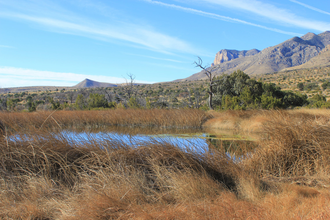
A small life giving oasis in the desert with the ever present El Capitan in the distance.
Higher up the narrow white trail, Frijole Ridge with its imposing 8,000 foot peaks, rises up directly in front of me. As far as I can see the terrain is brownish grey with snippets of green. Short plants hug the ground, roots digging deep and wide for a drop of precious water. Rabbits bounce between rocks, skittish and quick. Four mule deer catch my scent. Their ears move toward me before their heads. Then in one smooth but jerky motion, they face me before effortlessly gliding into the distance. There’s barely a cloud in the sky. The rustling wind, missing trees, branches and leaves, moves low along my legs, stirring the parched grass. My camera strap makes a hissing sound as it moves through the brush. Each step takes me higher and with a single curve in the path, everything around me changes.

The trail leading to Smith spring.
Directly in front of me alligator junipers twist into Texas madrones shedding their paper thin bark. Small leaf oaks stand next to maples, surrounded by a garden of maidenhair ferns. The sound of water moving over rocks leads to small, clear pools of water resting at the end of a flowing stream. Here the winds plays in the trees, moving through the leaves, each providing their own pitch. I had passed through a keyhole and walked into a glade of heaven. And after a moment, Lance and Walter stepped through the pearly gates. Lacking any self control, Big Lebowski jokes fill my brain and I have to stifle a laugh as I shake Walter’s hand.
For twenty minutes or so, we swapped stories. Lance has on a Mount Union cap, so we discuss what makes them the greatest DIII football program of all time. (My son Preston at Capital University kicks their ass in baseball each year.) Why the Indians failed to beat the Yankees (one word Kluber). Then we discussed our favorite parks and what makes them special. When I spoke about TheMountCo Project, Walter looked me directly in the eye and said “Smitty, that’s a noble cause.” Noble? “Yes. Bringing awareness of these places to people is a noble undertaking.” Walter, I’ve been associated with many things in my life, but never have any of them been described as noble. As a matter of fact, I don’t believe my name and the word noble have ever been used in the same sentence. “Just keep doing what you’re doing.” And so I will Walter. (That rug really tied the room together.)

A small pool of clear water with small oak leaves.

For the record Lance, I would go ahead and get the tattoo that says 2018 World Series Champs underneath the Indians logo. What could possibly go wrong? I mean they won it all in 1948.
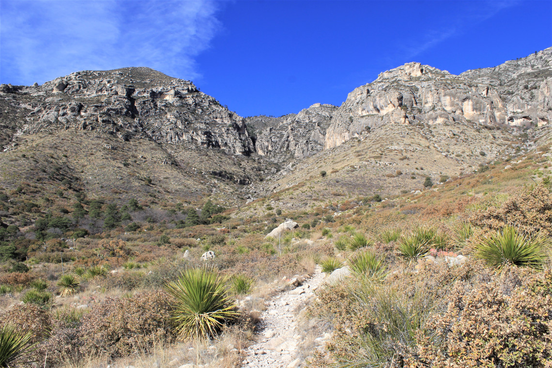
McKittrick Canyon is a 7.8 mile hike that leads you through a series of seeps and white arroyos filled with large boulders, scattered across dry flats rock like marbles dropped from a hand. As you walk into the canyon you are entering Capitan Reef on the seaward side. Layers of the exposed reef mark the steep edges of McKittrick Creek. Deeper in the canyon the landscape turns lush and most traces of the desert fall away. Birds move in an out of trees lining the trail. Sounds move in the underbrush and I turn to see the back half and large bushy tail of a grey fox before it silently vanishes. As I turn up a trail marked by two stone-stacked pillars, a woodpecker begins a fresh mark.

Two pillars announced the entrance To Wallace Pratt’s stone cabin.
n 1921, a young geologist named Wallace E. Pratt came to McKittrick Canyon. There is a video interview at the visitors center where he says, “I fell in love with it now.” I love that quote. Captivated by its beauty and geology, he knew what he wanted. In 1932 he completed a stone cabin at the confluence of north and south McKittrick. This isolated structure served as his part-time home and retreat. It’s a magnificent cabin and as I rested in one of the many rocking chairs on the stone porch, I tried to imagine the effort and skill that went into its making. Cowboys on horseback pulling rocks from the washes, Pratt’s vision directing their ropes. Rough plank chairs carved from trees felled by hand. The stone cabin remains as a testament to his spirit and I didn’t want to leave. But slowly I did rise and made my way back down the trail, led by a silver moon against a brilliant blue sky.
Hiking into McKittrick Canyon. There are 1,434 rattlesnakes in this photo

A stream moves down from the canyon.

Where the landscape turns lush. It is an amazing transformation over the course of a few short hours walk.
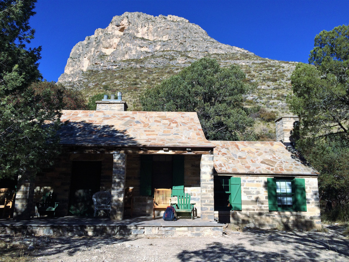
In 1957, Wallace Pratt donated 5,632 acres of his beloved property to the U.S. Government for the creation of a national park.

Leaving McKittrick Canyon. I kept thinking of Tim Burton.

For some reason I like to put my hand on trees. I’m thinking about seeing someone for it

I tried to find the technical name for this pyramid shaped mountain and all I could find was pyramid shaped mountain.

Two mule deer giving me the stink eye. We had a staring contest and they won. They always do.